


この記事には広告を含む場合があります。
記事内で紹介する商品を購入することで、当サイトに売り上げの一部が還元されることがあります。
第59回気象予報士試験実技2より、前線記入問題のみ選びました。
前線記入について集中して勉強したい場合に使ってください。
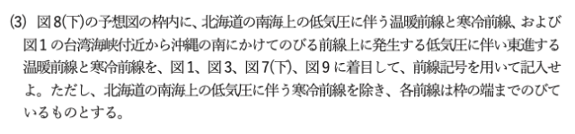
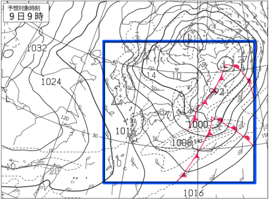
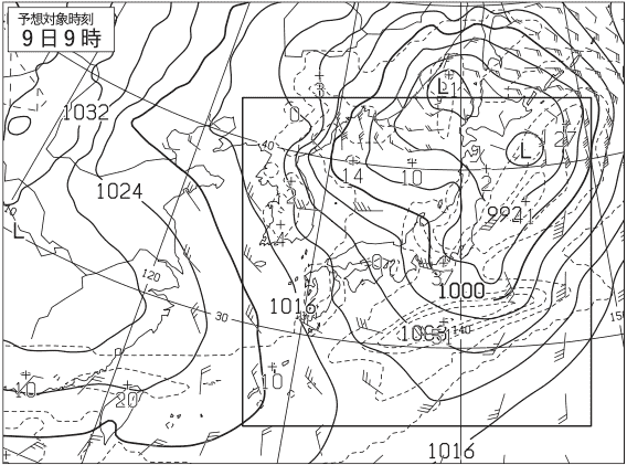
問題
問題文より求める前線は次の通り。
- 北海道の南海上の低気圧に伴う温暖前線と寒冷前線
(温暖前線は枠の端まで伸びている。)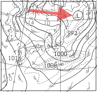
- 図1(初期時刻)で台湾海峡から沖縄の南にかけてのびる前線上に発生する低気圧に伴い東進する温暖前線と寒冷前線
(温暖前線、寒冷前線共に枠の端まで伸びている。)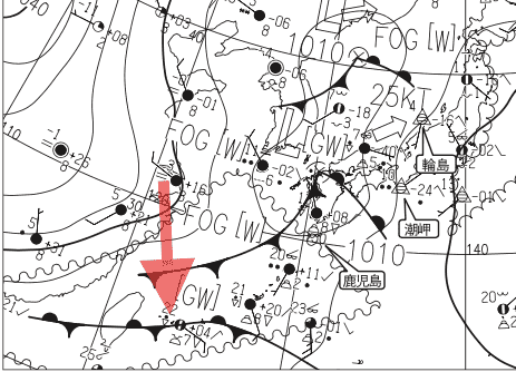
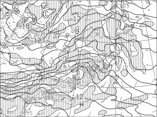
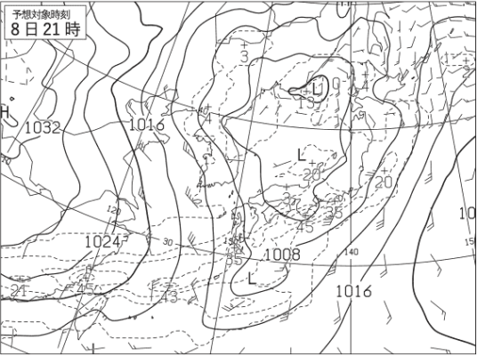
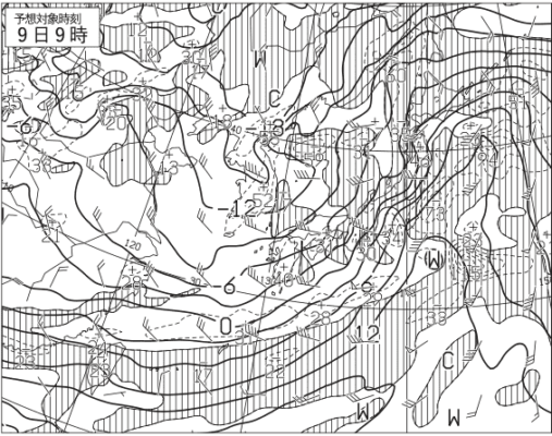
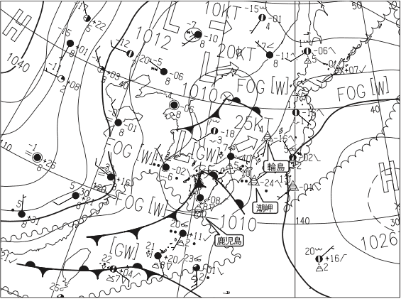
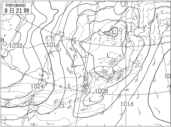
着目する天気図
問題文より、着目する天気図は、図1,3,7(下),9。


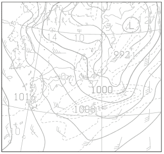
模範解答
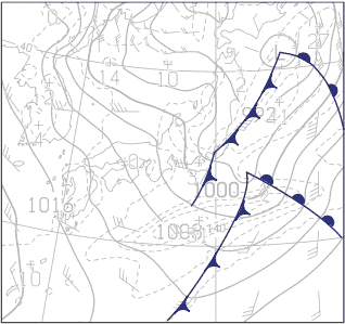
模範解答と同時刻の天気図を重ねる
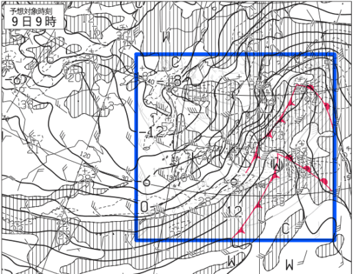
着目する天気図を時系列に見る
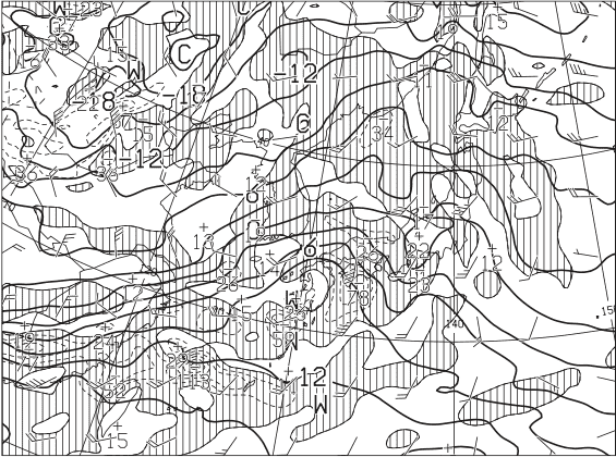
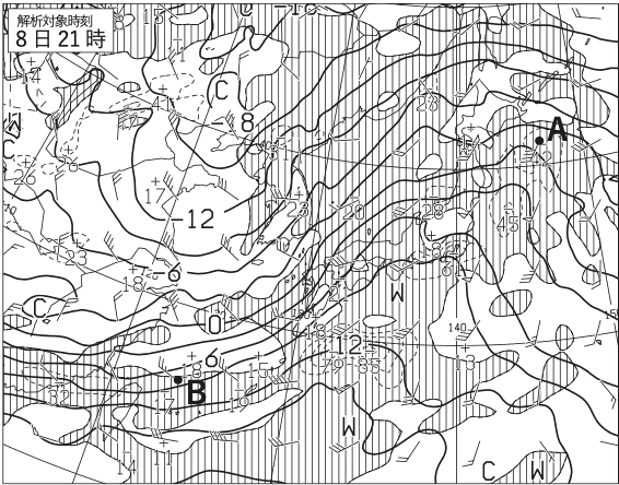
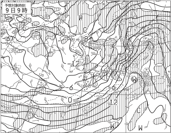
前線位置の考察ポイント
この問題では、前線の位置を決定する要素は地上気圧・降水量・風予想図と850hPa気温・風,700hPa鉛直流予想図のみであることから、以下のことに注目すると、前線の位置を確定しやすくなると思います。
- 初期時刻において、前線が850hPa面のどの等温線と一致しているか。
- 地上天気図における時系列の位置変化。